Catalog Archive
Auction 140, Lot 538

"Tabula Aquitaniae complectens Gubernationem Guiennae, et Vasconiae", Homann, Johann Baptist

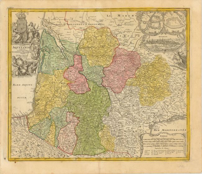
Subject: Southern France

Period: 1716 (published)

Publication: Grosser Atlas

Color: Hand Color

Size:
22.5 x 19 inches
57.2 x 48.3 cm
Download High Resolution Image
(or just click on image to launch the Zoom viewer)

This is a large and decorative map of southwestern France, fully engraved with mountains, forests, roads and cities. Decorative borders surround the three insets: fortification plans of Bayonne and Blaye, and a fine vignette bird's-eye view of the city of Bordeaux. The map carries good detail of the Pyrenees and a highly detailed depiction of the Canal du Midi, here labeled the Canal Royal. This fantastic undertaking connected the Atlantic (via the Garonne River) with the Mediterranean in one of the most incredible engineering feats of the 17th century. It was opened in 1681 after fourteen years of construction under the direction of Pierre Paul Riquet. The map is further embellished with a large, allegorical title cartouche.

References:

Condition: B+

Original color on watermarked paper with a 3" tear along a printer's crease at bottom center that has been closed on verso with archival tape and minor soiling.

Estimate: $180 - $210

Sold for: $100

Closed on 5/23/2012

Archived