Catalog Archive
Auction 140, Lot 522

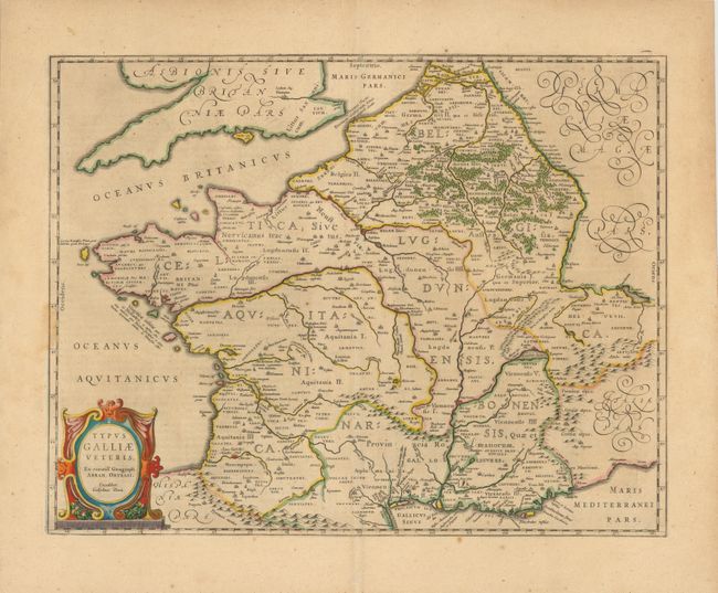
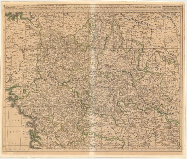
"[Lot of 2] Typus Galliae Veteris [and] Aurelianensis Praefectura Generalis…",

Subject: France

Period: 1635-1700 (circa)

Publication:

Color: Hand Color

Size:
See Description
Download High Resolution Image
(or just click on image to launch the Zoom viewer)

A. Typus Galliae Veteris, by Willem Blaeu, circa 1635 (20 x 15.5"). Handsome map of ancient France, based on the cartography of Abraham Ortelius, who is credited in the cartouche. Fully engraved with mountains, forests and ancient place names and decorated with a strapwork title cartouche. German text on verso. Condition: Wide margins, with a stain in border at left that does not distract. (A)

B. Aurelianensis Praefectura Generalis…, Gerard and Leonard Valck, circa 1700 (23.5 x 19.2"). Very strongly engraved map centered on Orleans and Tours. The map extends to the Atlantic at the Bay of Biscay and east to Burgundy. Fortified towns are identified and hundreds of small villages are named. Locates Thiers, Uzerche, Niort, Nantes, Rennes, Seez, Auxerre, and many more. Two distance scales at upper right and legend opposite. Condition: Very dark impression and original outline color. On thick, sound paper that was previously framed leaving behind mounting paper on verso at edges and overall toning from framing. The centerfold backstrap protected this region from toning resulting in a lighter area. (B)

References:

Condition:

See description.

Estimate: $190 - $230

Sold for: $140

Closed on 5/23/2012

Archived