Catalog Archive
Auction 140, Lot 504

"Carte von den Laendern Anglen und Schwansen", Danckwerth, Casper

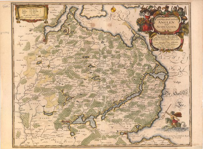
Subject: Denmark, Germany

Period: 1649 (dated)

Publication: Newe Landesbeschreibung der Zwei Hertzogthumer Schleswich und Holstein…

Color: Hand Color

Size:
21 x 16.8 inches
53.3 x 42.7 cm
Download High Resolution Image
(or just click on image to launch the Zoom viewer)

This map depicts the region of Sleswig, which is about 80 miles long and is roughly divided in half between Denmark and Germany. This area was of strategic importance in the transfer of goods between the Baltic and North Seas, opening trade routes between Russia and Western Europe. The map is adorned by a title cartouche surrounded by farmers and their harvest, a drape-style distance scale cartouche, and Neptune riding a sea horse. Drawn by Johannes Meyer and engraved by Matthias and Claus Petersen. The map appeared in Caspar Danckwerth and Johannes Meyer's Newe Landesbeschreibung der Zwei Hertzogthumer Schleswich und Holstein…, which was published in 1652.

References: Shirley (BL Atlases) T.Danc-1-a #20.

Condition: B

There is some light offsetting and a few spots in the image. The bottom corners have been reinforced with old paper.

Estimate: $275 - $350

Unsold

Closed on 5/23/2012

Archived