Catalog Archive
Auction 140, Lot 48

"A Correct Draught of the North Pole…", Bowen, Emanuel
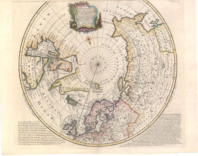
Subject: North Pole

Period: 1747 (circa)

Publication: Navigantium atque itinerantium bibliotheca…

Color: Hand Color

Size:
17.5 x 15.5 inches
44.5 x 39.4 cm
Download High Resolution Image
(or just click on image to launch the Zoom viewer)

A highly detailed map that shows the tracks of navigators in their numerous attempts to find a northern passage to the economic riches of Asia. The map shows great information on the hunt for the Northwest Passage via Hudson Bay. Much of Greenland and the western part of North America remain undiscovered. A decorative title cartouche obscures the unknown northwest coast. Panels of English text at the bottom describe the explorations and probabilities of finding a Northwest Passage via Hudson Bay, with particular interest in the outcome of the 1746 Arthur Dobbs expedition. Published by John Harris.

References: Kershaw #418.

Condition: B+

Trimmed at top with some loss of neatline. There are tiny archivally repaired tears and chips in blank margins, a few of which just enter neatline at top.

Estimate: $425 - $500

Sold for: $325

Closed on 5/23/2012

Archived