Catalog Archive
Auction 140, Lot 440
"A Correct Chart of the English Channel from the No. Foreland to the Lands End…", Seale, Richard William
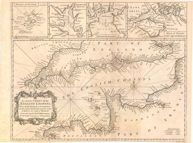
Subject: Britain
Period: 1745 (circa)
Publication: Tindal's Continuation of Mr. Rapin's History of England
Color: Black & White
Size:
18.8 x 15 inches
47.8 x 38.1 cm
Download High Resolution Image
(or just click on image to launch the Zoom viewer)
(or just click on image to launch the Zoom viewer)