Catalog Archive
Auction 140, Lot 417

"Pas-Caarte van de Canarise, Vlaemse, en Groen-Eylanden, tot de Caribse Eylanden, mitsgaders de Zee-Custen vant Vaste Lant daer Bezuyden en Benoorden", Colom, Jacob Aertz

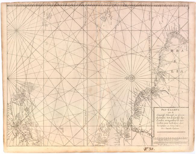
Subject: Western Atlantic Ocean

Period: 1663 (circa)

Publication: Atlas of Werelts-water-deel

Color: Black & White

Size:
21 x 16.5 inches
53.3 x 41.9 cm
Download High Resolution Image
(or just click on image to launch the Zoom viewer)

Colom's chart was originally derived from Jacobsz' Pascaert vande Carybes… and also appears to incorporates his son Arnold Colom's version of the chart circa 1656. The map depicts the North American coastline from Long Island (Haeck vande Visschers) to Newfoundland, the Lesser Antilles, and the northern coastline of South America. Numerous islands are depicted in the Atlantic, including the Bermudas, the Azores Islands and the Cape Verde Islands. Detail is confined to the coastlines, with many place names and navigational hazards depicted. North is oriented to the left with a delicately engraved compass rose. This is the first state.

References: Burden #376.

Condition: B

Printed on heavy paper with light toning and soiling, two tiny worm holes near center, and small, scattered spots. Top margin is trimmed to the neatline with some loss at left. Manuscript page number below map.

Estimate: $1,100 - $1,400

Unsold

Closed on 5/23/2012

Archived