Catalog Archive
Auction 140, Lot 415

"Carte Reduite de l'Ocean Atlantique Meridional…", Depot de la Marine

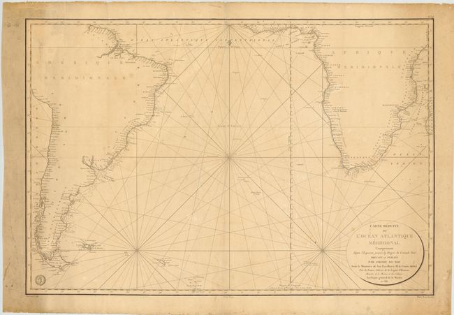
Subject: South Atlantic

Period: 1818 (dated)

Publication:

Color: Black & White

Size:
35.8 x 24.5 inches
90.9 x 62.2 cm
Download High Resolution Image
(or just click on image to launch the Zoom viewer)

This large-scale sea chart of the southern Atlantic depicts most of South America, including the Pacific coastline up to Pisco, and Southern Africa, including the Indian Ocean coastline up to Juba. There is great detail of islands, coastal ports and harbors, including soundings and the locations of anchorages. The map is adorned with rhumb lines, a fleur-de-lis, the Depot de la Marine emblem and an oval cartouche. Engraved by E. Collin. Prix Trois Francs is stated just outside of the neatline at bottom right.

References:

Condition: B

Some soiling and damp stains, primarily in the blank margins. There are a few light folds, with two small separations at fold intersections near center and southern coastline of Africa.

Estimate: $350 - $450

Unsold

Closed on 5/23/2012

Archived