Catalog Archive
Auction 140, Lot 392

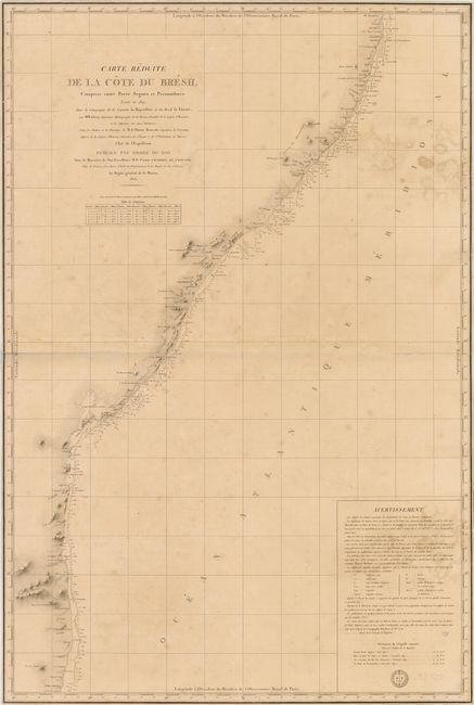
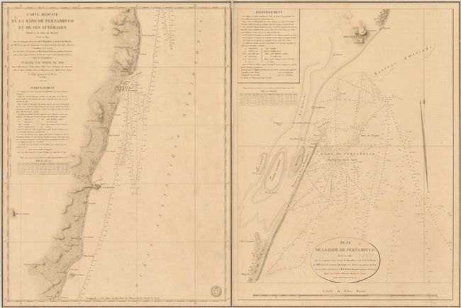
"[Lot of 3] Carte Reduite de la Cote du Bresil Comprise entre Porto Seguro et Pernambuco… [and] Carte Reduite de la Cote du Bresil Comprise entre Pernambuco et Ciara [and] Carte Reduite de la Rade de Pernambuco…", Depot de la Marine

Subject: Brazil

Period: 1824-26 (dated)

Publication:

Color: Black & White

Size:
See Description
Download High Resolution Image
(or just click on image to launch the Zoom viewer)

These detailed navigational charts outline the coast of Brazil and are based on an expedition tracked by M.M. Givry along the coast in 1819 and 1820. The charts cover the eastern coast from Porto Seguro in the south past Fortaleza (Ceara) in the north, noting Recife (Pernambuco), Salvador, and numerous other cities along the coast. The seal of the Depot de la Marine is engraved on each map.

A. Carte Reduite de la Cote du Bresil Comprise entre Porto Seguro et Pernambuco, dated 1825 (23.8" x 35.5"). Condition: There are damp stains, a few archivally repaired tears at right, and a couple of tiny worm holes.

B. Carte Reduite de la Cote du Bresil Comprise entre Pernambuco et Ciara/I>, dated 1826 (35.8" x 24"). Condition: There are some faint spots in the image and faint pencil marks in the Atlantic. The top left corner is chipped with slight loss of neatline.

C. Carte Reduite de la Rade de Pernambuco et de ses Atterages Situes a la Cote Du Bresil… [on sheet with] Plan de la Rade de Pernambuco/I>, dated 1824 (36" x 24"). Condition: There are a couple of extraneous creases with a short tear along one crease at top and some faint spots. The two maps are joined together on verso with archival tape.

References:

Condition: B

All maps have light soiling and are trimmed to the neatlines. See description for more details.

Estimate: $400 - $500

Sold for: $300

Closed on 5/23/2012

Archived