Catalog Archive
Auction 140, Lot 368

"The Island of Becouya…", Norie, John William

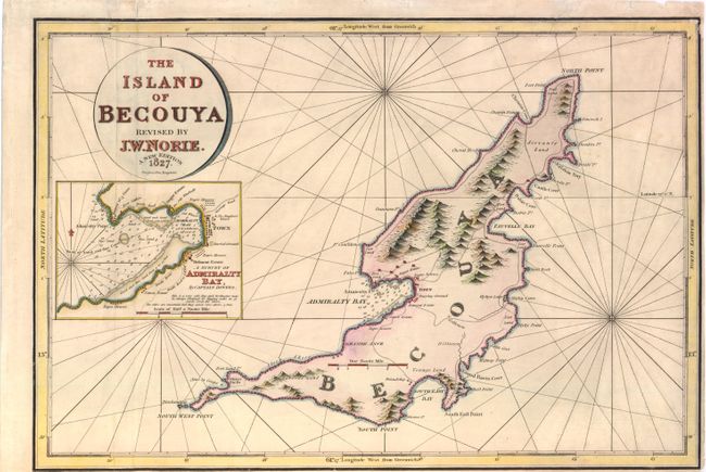
Subject: The Grenadines, Bequia

Period: 1827 (dated)

Publication:

Color: Hand Color

Size:
18.5 x 12.5 inches
47 x 31.8 cm
Download High Resolution Image
(or just click on image to launch the Zoom viewer)

A lovely and rare navigational chart of the island of Bequia, just south of St. Vincent in the Grenadines. The rocky coastline and the topography are well depicted in addition to the few roads and villages on the island. A large inset shows Admiralty Bay, as surveyed by Captain Dovers, with numerous soundings and navigational hazards. The inset includes details such as "the only windmill," a battery of three guns, a burial ground, and "negro houses." Bequia and the Grenadine islands were ceded to Britain in the Treaty of Paris in 1763, and the islands remained under British control until their independence in 1979.

References:

Condition: B

Light soiling with a couple of minor abrasions and minute worm holes, and short fold separations that have been closed on verso with archival materials. There are three tears that enter about 1/2" into map at top that have also been closed with archival materials. Narrow right and bottom margin.

Estimate: $375 - $450

Sold for: $275

Closed on 5/23/2012

Archived