Catalog Archive
Auction 140, Lot 364

"Insula Barbadoes in suas Parochias Distincta, una cum Oris Maritimis, Viis &c. ad Fidem Anglicani Authoris Delineata", Homann Heirs
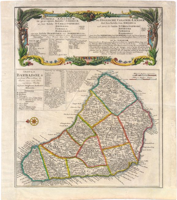
Subject: Barbados

Period: 1737 (circa)

Publication:

Color: Hand Color

Size:
11 x 13.3 inches
27.9 x 33.8 cm
Download High Resolution Image
(or just click on image to launch the Zoom viewer)

This bold copper-engraved map of Barbados was copied from Moll's map of 1729. The island is divided into parishes, with numerous cities, churches, plantations, and roads depicted. A decorative compass rose orients west at the top of the map. Contained in the title cartouche are a legend, a list of the eleven parishes with their population, and a note giving a brief history of Barbados from the reign of King James I. The Barbados map was one of five maps on the sheet, including St. Kitts, Antigua, Bermuda, and Jamaica, which have been trimmed from this folio sheet. Above the map is an elaborate title cartouche for the whole sheet in both Latin and German, decorated with coconut trees and local flowers.

References: Campbell, Tony (MCC-21) #26.

Condition: B+

Light soiling, a few creases, and a minute tear in title cartouche that has been archivally repaired. Trimmed to neatlines at left and bottom and remargined.

Estimate: $170 - $200

Sold for: $130

Closed on 5/23/2012

Archived