Catalog Archive
Auction 140, Lot 347

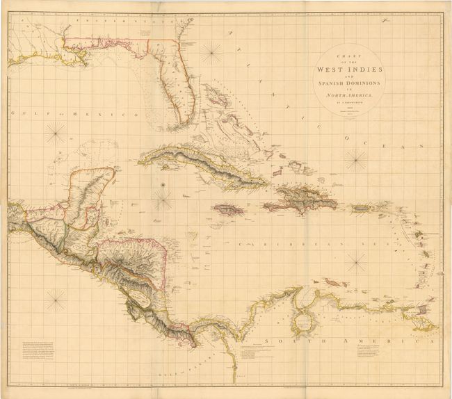
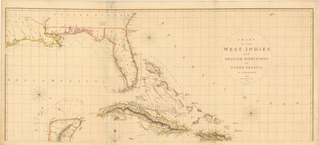
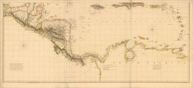
The Most Accurate Chart of the West Indies at the Beginning of the 18th Century

"[On 2 Sheets] Chart of the West Indies and Spanish Dominions in North America", Arrowsmith, Aaron, Sr.

Subject: Gulf of Mexico and Caribbean

Period: 1810 (dated)

Publication:

Color: Hand Color

Size:
55.1 x 23.8 inches
140 x 60.5 cm
Download High Resolution Image
(or just click on image to launch the Zoom viewer)

At the time of its publication, Arrowsmith’s impressive chart of the West Indies was the most accurate map of the region. It was drawn from several important surveys including those of John William Gerard de Brahm of the Georgia coast, Bernard Romans of Florida, and Spanish surveys of the Gulf of Mexico. First issued in 1803, this is the second state, with additions to 1810 and the width reduced eliminating the portion covering Mexico and the southwestern US. The map gives great detail of the coastlines with soundings, anchorages, and navigational hazards. The interior of the US is blank with the exception of rivers and a few place names, and reaches west just past Galveston Bay. Florida is divided into East and West along the St. Marks River, and West Florida extends to the Mississippi River. There is great topographical detail of the Caribbean islands and Central America. The map also includes several interesting notes including one in Central America describing the "Canals proposed to be cut by the Spaniards in 1528." Four sheets, joined to form two large sheets, as issued. Size is for each sheet; map would measure 56 x 47.5" if all four sheets were joined.

References: Stevens & Tree (MCC-39) #89b.

Condition: B+

Original color with light offsetting, a few small spots, and toning in left blank margin extending into border. There are some short fold separations that have been archivally repaired.

Estimate: $5,000 - $7,000

Sold for: $3,500

Closed on 5/23/2012

Archived