Catalog Archive
Auction 140, Lot 346

"Map of the European Settlements in Mexico or New Spain and the West Indies", Kitchin, Thomas

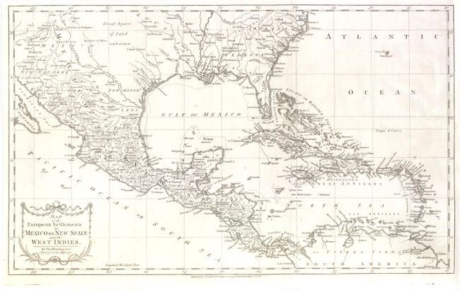
Subject: Gulf of Mexico and Caribbean

Period: 1783 (dated)

Publication: Robertson's History of America

Color: Black & White

Size:
20 x 12.3 inches
50.8 x 31.2 cm
Download High Resolution Image
(or just click on image to launch the Zoom viewer)

This detailed and expansive map covers all of the southern United States north to the Carolinas at Cape Henry. The map continues west through the region labeled Great Space of Land unknown to the southern tip of Baja California. All of the Caribbean is shown, naming the Great Antilles, Cuba, and the Bahamas, with the Windward and Leeward together identified as the Caribbe Is. It is filled with place names and rivers and Indian tribes. The map is decorated with a delicate title cartouche.

References:

Condition: A

Issued folding, now pressed with a minute hole at a fold intersection, and another caused by a paper flaw, both of which are only visible when held to light. Remargined at top right.

Estimate: $275 - $350

Sold for: $150

Closed on 5/23/2012

Archived