Catalog Archive
Auction 140, Lot 314

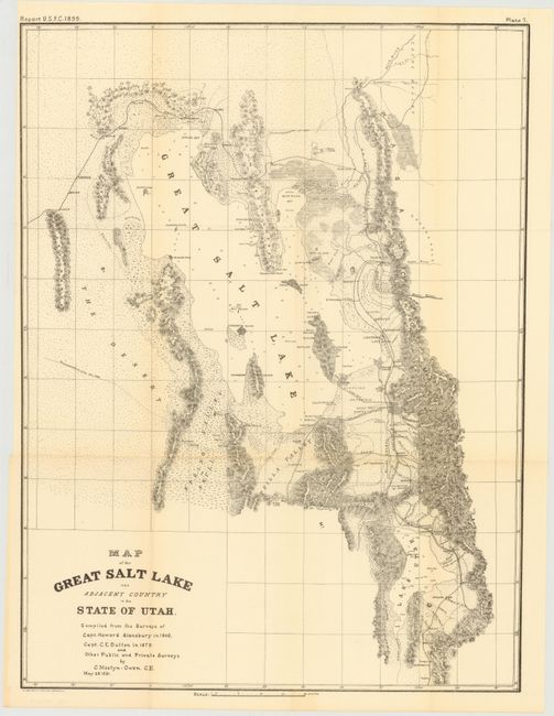
"Map of the Great Salt Lake and Adjacent Country in the State of Utah", U.S. Government

Subject: Utah

Period: 1899 (dated)

Publication:

Color: Black & White

Size:
16.8 x 22.5 inches
42.7 x 57.2 cm
Download High Resolution Image
(or just click on image to launch the Zoom viewer)

This uncommon map shows the progress and growth in the area around the Great Salt Lake. Published by the U.S. Forestry Commission in 1899, it was "Compiled from the Surveys of Capt. Howard Stansbury in 1849, Capt. C.E. Dutton in 1879 and Other Private and Public Surveys by C. Mostyn-Owen. C.E. May 25, 1891." It is filled with information on towns and settlements, railroads, watershed, and topography via hachure. We find no references or catalog listings for this map. Lithographed by Norris Peters Co. in Washington D.C.

References:

Condition: A

There is a hint of toning along a few folds and a narrow, but adequate, left margin. Issued folding.

Estimate: $120 - $150

Sold for: $60

Closed on 5/23/2012

Archived