Catalog Archive
Auction 140, Lot 294

"[Geologic Map of the Lake Placid Quadrangle]",

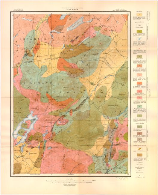
Subject: Lake Placid, New York

Period: 1916 (circa)

Publication:

Color: Printed Color

Size:
15.5 x 19.5 inches
39.4 x 49.5 cm
Download High Resolution Image
(or just click on image to launch the Zoom viewer)

This attractive geologic map is focused on Lake Placid and the surrounding area. A key at right identifies 18 different geologic units as well as fault zones, dip and strike of foliation, glacial striae, and stone quarries and mines. The geology was completed by W. J. Miller in 1915-16 and the base map was engraved by the U.S. Geological Survey in 1896. The map fits in a brown paper envelope printed with the title of the map.

References:

Condition: A

Issued folding with just a hint of toning. The envelope is toned with numerous small chips and is a bit brittle.

Estimate: $120 - $150

Sold for: $75

Closed on 5/23/2012

Archived