Catalog Archive
Auction 140, Lot 292

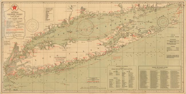
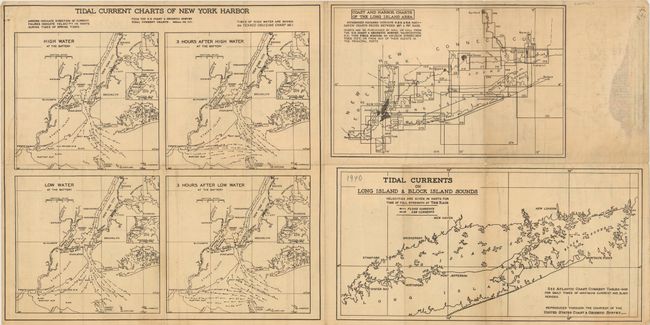
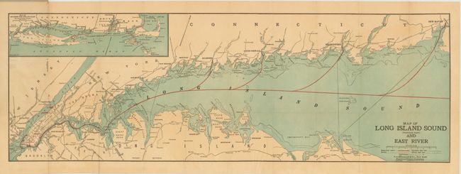
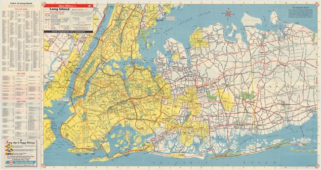
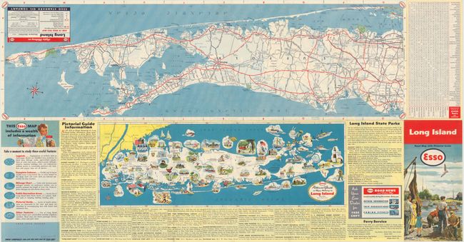
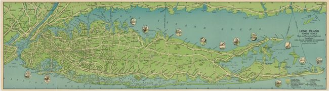
"[Lot of 4] Texaco Cruising Chart Long Island & Long Island Sound [and] Map of Long Island Sound (Western Part) and East River [and] Long Island Road Map with Pictorial Guide [and] Long Island Sunrise Trails…",

Subject: Long Island, New York

Period: 1917-51 (circa)

Publication:

Color: Printed Color

Size:
See Description
Download High Resolution Image
(or just click on image to launch the Zoom viewer)

This lot of four focused on Long Island includes:

A. Texaco Cruising Chart Long Island & Long Island Sound, by the Texas Company, circa 1940, (30.8" X 15.5"). Includes detailed nautical information and an index to yacht clubs. The verso contains tidal charts for New York Harbor and Long Island. Condition: Minor soiling. (B+)

B. Map of Long Island Sound (Western Part) and East River, by C. S. Hammond & Co., circa 1917, (28" x 9.5"). Shows the steamboat routes in Long Island Sound and an inset of Long Island, Nantucket and Cape Cod. Folds into gray paper wrappers. Condition: There is some minor loss in blank areas of image along fold at left and some light toning. Wrappers are worn and have a fold separation. (B)

C. Long Island Road Map with Pictorial Guide, by Esso Co., dated 1951, (31.5" x 16.8"). One side shows a large map of the western section while the verso shows the eastern side and the "Esso Pictorial Guide to Happy Motoring in Long Island." Condition: (A+)

D. Long Island Sunrise Trails Main and Secondary Highways, by Rand McNally & Co., circa 1928, (31.3" x 8.5"). Shows roads, railroads, ferries and 13 small pictorial scenes around Long Island. Condition: (A)

References:

Condition:

See descriptions.

Estimate: $120 - $150

Sold for: $75

Closed on 5/23/2012

Archived