Catalog Archive
Auction 140, Lot 264

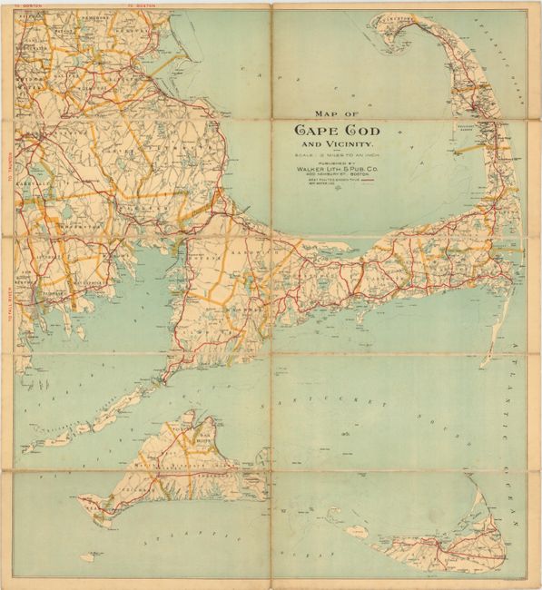
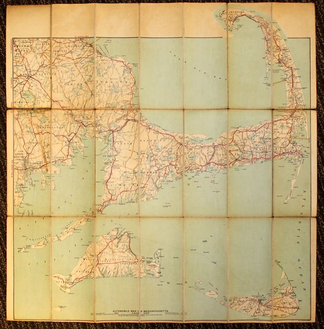
"[Lot of 2] Map of Cape Cod and Vicinity [and] Automobile Map of Massachusetts. Cape Cod", Walker Lithograpic & Publishing Co.

Subject: Cape Cod, Massachusetts

Period: 1900-08 (circa)

Publication:

Color: Printed Color

Size:
See Description
Download High Resolution Image
(or just click on image to launch the Zoom viewer)

This lot features two automobile maps of the Cape Cod area including Nantucket and Martha's Vineyard, both published by the Walker Lithographic & Publishing company. The maps display the "best" highway routes in red and show numerous other roads, railroads and abundant coastline. Both maps are dissected and mounted onto linen with brown paper labels.

A. Map of Cape Cod and Vicinity, circa 1900, (18.5" x 20.5"). Condition: Light toning and a few minor spots, else very good. (B+)

B. Automobile Map of Massachusetts. Cape Cod, dated 1908, (29" x 30.8"). Condition: The map is toned and the linen is partially separated along a few of the fold intersections. (B)

References:

Condition:

See descriptions.

Estimate: $200 - $250

Sold for: $230

Closed on 5/23/2012

Archived