Catalog Archive
Auction 140, Lot 217

"Map of Berkeley and Vicinity",

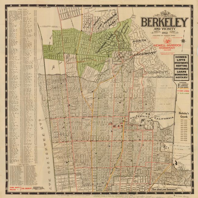
Subject: Berkeley, California

Period: 1912 (dated)

Publication:

Color: Printed Color

Size:
22.8 x 23 inches
57.9 x 58.4 cm
Download High Resolution Image
(or just click on image to launch the Zoom viewer)

This is a rare single-sided real estate promotional map of the City of Berkeley and surrounding areas issued by Charles Green on behalf of the Newell-Murdoch Company, Real Estate. Key routes, car lines and S.P. lines (presumably Southern Pacific) are highlighted in different colors with Thousand Oaks, Fairmont Park, Arlington Heights, Northbrae, and Regents Park developments north of the city highlighted in green. The map focuses on land tracts (all named) and street layouts with indices to street names and fire alarm boxes given on the left side of the sheet. Important buildings, schools and fire houses are shown (some named in red) as is the University of California campus as it existed in 1912. An attractive map of this well known Bay Area city.

References:

Condition: B+

Issued folding with some minor soiling and pencil notations in the image and in the bottom margin.

Estimate: $350 - $450

Sold for: $300

Closed on 5/23/2012

Archived