Catalog Archive
Auction 140, Lot 211

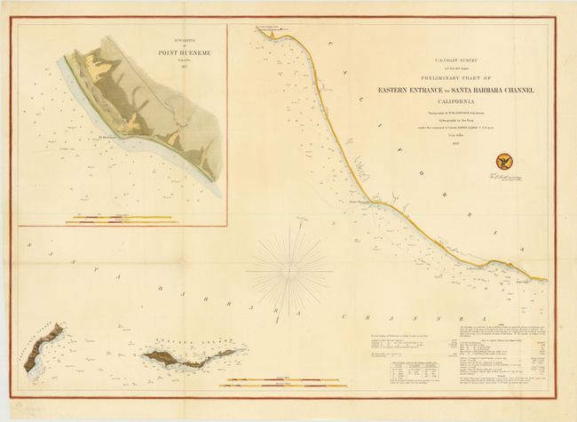
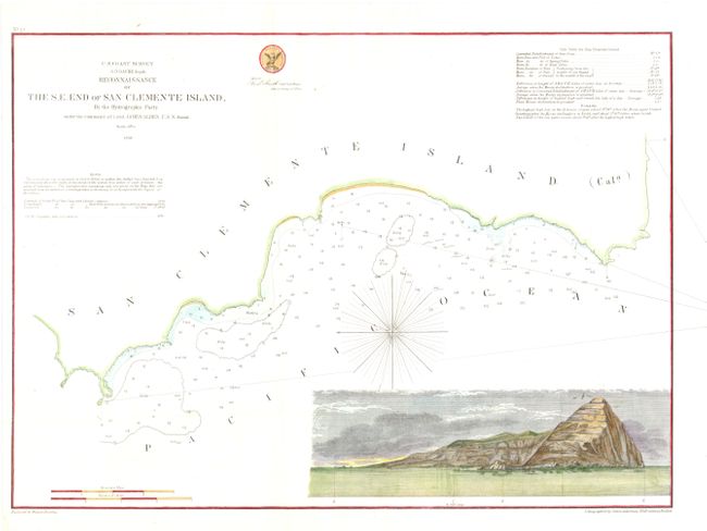
"[Lot of 2] Preliminary Chart of Eastern Entrance to Santa Barbara Channel [and] Reconnaissance of the S. E. End of San Clemente Island", U.S. Coast Survey

Subject: California

Period: 1856-57 (dated)

Publication:

Color: Hand Color

Size:
See Description
Download High Resolution Image
(or just click on image to launch the Zoom viewer)

The Office of Coast Survey is the oldest U.S. scientific organization, dating from 1807 when Congress directed that a "survey of the coast" be carried out. By 1836, it was called the U.S. Coast Survey and in 1878, the name was changed to the U.S. Coast and Geodetic Survey. Today the Office of Coast Survey is a division of the National Oceanic and Atmospheric Administration NOAA.

The survey teams, composed of civilians as well as Army and Naval officers, charted the nation's waterways and produced a wide array of reports, survey charts, hydrographic studies of tides and currents, astronomical studies and observations, and coastal pilots. These charts are an important record of the changing nature of the nation's coastlines. In additional to coastal charts, the U.S. Coast and Geodetic Survey produced land sketches, Civil War battle maps, and the early aeronautical charts.

A. Preliminary Chart of Eastern Entrance to Santa Barbara Channel, dated 1857, (23 x 16.3"). This chart details the coastline from San Buena Ventura to Point Hueneme and to Point Magu, with soundings and bottom type noted. Offshore are sketches of Santa Cruz and Anacapa Islands. An inset, "Sub-Sketch of Point Hueneme," shows the proposed site for a lighthouse. Condition - there is a small split at a fold intersection and a binding trim (barely touhcing neatline) in lower left margin. Issued folding and now flat (B+).

B. Reconnaissance of the S. E. End of San Clemente Island, dated 1856, (16.5 x 12"). This chart details the coastline, bottom type and soundings of San Clemente Island. The large inset is a sea view of the island with a sailing ship anchored offshore. Both maps are by the Hydrographic Party under the command of Lieut. James Alden, USN. Condition - nice example. Issued folding, now pressed (A).

References:

Condition:

See descriptions.

Estimate: $200 - $250

Unsold

Closed on 5/23/2012

Archived