Catalog Archive
Auction 140, Lot 153

"Carte de la Nouvelle Angleterre New York Pensilvanie et Nouveau Jersay Suivant les Cartes Angloises", Bellin, Jacques Nicolas

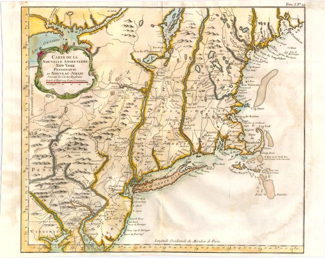
Subject: Colonial New England and Mid-Atlantic

Period: 1764 (published)

Publication: Le Petit Atlas Maritime

Color: Hand Color

Size:
14.5 x 12.6 inches
36.8 x 32 cm
Download High Resolution Image
(or just click on image to launch the Zoom viewer)

Scarce, larger version of Bellin's map of New England with cartography taken from Moll. This is not to be confused with the smaller, more common map of nearly the same title. The map shows the area from Penobscot Bay in Maine down to Little Egg Harbor (Havre du Petit Oeuf) in New Jersey and a bit of Delaware Bay, and extends west to Lake Ontario. Cape Cod is shown as an island, and Martha's Vineyard is named Martha's Wineyard. The map is finely engraved and filled with place names both along the coast and inland, including Casco Bay, Cape Porpoise, Cape Anne, Boston, Providence and many more. Adorned with a rococo-style title cartouche.

References: McCorkle #764.1; Sellers & Van Ee #723 & 764.

Condition: B

Issued folding with a tiny hole at the fold intersection and some light stains. Remnants of paper hinge tape on verso.

Estimate: $600 - $800

Unsold

Closed on 5/23/2012

Archived