Catalog Archive
Auction 140, Lot 115

"A General Map of North America from the Latest Observations", Lodge, John

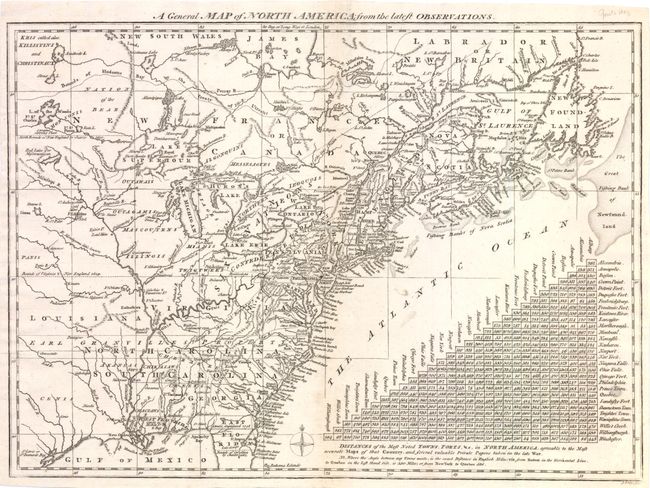
Subject: Colonial United States and Canada

Period: 1778 (published)

Publication: The North American Gazzetteer

Color: Black & White

Size:
15 x 10.8 inches
38.1 x 27.4 cm
Download High Resolution Image
(or just click on image to launch the Zoom viewer)

An interesting map showing the British view of their colonies at the outbreak of the American Revolution. Based on the cartography of Thomas Jefferys, the map covers from James Bay to the Gulf of Mexico and provides many details about the frontier wilderness, including numerous early forts, Indian villages and tribal territories. The mythical islands in Lake Superior are a hold-over from earlier French cartographers. The large triangular table at the lower right provides distances between major cities and forts. Shows Earl Granville's Property in North Carolina extending beyond the Mississippi River.

References: McCorkle #776.15; Sellers & Van Ee #160.

Condition: B

There is faint toning and a few tiny tears along centerfold, along with a few minor spots and abrasions.

Estimate: $650 - $750

Sold for: $325

Closed on 5/23/2012

Archived