Catalog Archive
Auction 139, Lot 669

"Carte de la Baye et du Port de Trinquemalay dans l'Isle de Ceylan Levee Exactement en 1762 par le Sr. Ge. Neichelson…", Apres de Mannevillette, Jean B. N. D.
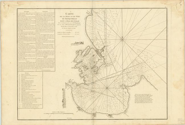
Subject: Sri Lanka

Period: 1775 (published)

Publication: Le Neptune Oriental

Color: Black & White

Size:
26 x 19.1 inches
66 x 48.5 cm
Download High Resolution Image
(or just click on image to launch the Zoom viewer)

This detailed nautical chart depicts the Bay of Trincomalee, a strategic sea port in the international trading history of Sri Lanka located on the northwest coast. The chart is fully engraved with great detail of the coastline and countless soundings, and features a legend identifying 23 locations, a compass rose and two views of the coastline. Columns of French text at left give detailed sailing instructions.

References:

Condition: B+

Watermarked paper with wide side margins, faint offsetting and a few minor spots of soiling. There are faint damp stains in upper corners, far from map image, and marginal soiling.

Estimate: $250 - $350

Unsold

Closed on 2/15/2012

Archived