Catalog Archive
Auction 139, Lot 617

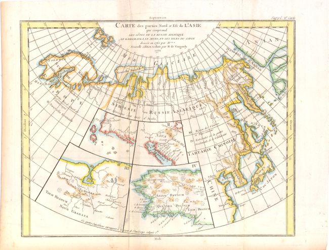
"Carte des Parties Nord et Est de l'Asie qui Comprend Les Cotes de La Russie Asiatique le Kamschatka, Le Jesso, et Les Isles Du Japan", Robert de Vaugondy, Didier

Subject: Northern Asia and Western North America

Period: 1772 (dated)

Publication: Diderot's Encyclopedie

Color: Hand Color

Size:
15 x 12 inches
38.1 x 30.5 cm
Download High Resolution Image
(or just click on image to launch the Zoom viewer)

This unusual map details the northern coastline of Russia (including Scandinavia), the eastern coast of Asia to below Nanking, and a bit of the coast of America called Anian. Inset into the map are four small maps of the western part of North America: I - Features the entire western coast with Japan just a short distance offshore; II - Focuses on Nova Granada showing the Mexican coast of the Gulf of California; III - Focuses on the Zubgara and Tolm Regnum of Nova Granada and the mythical seven cities of Cibola; and IV - Depicts Anian Regnum including Quivira Regnum and another Tolm Regnum. All together a fascinating view of some of the early cartographic theories concerning the western part of North America.

References: Pedley #406. & p. 79; Wagner (NW) #637.

Condition: B+

Issued folding on watermarked paper with light toning along one vertical fold and a short fold separation in bottom blank margin that does not enter map image. Some light toning in blank margins at bottom and left.

Estimate: $130 - $160

Unsold

Closed on 2/15/2012

Archived