Catalog Archive
Auction 139, Lot 612

"Asia, Drawn from the Latest and Best Authorites", Kitchin, Thomas
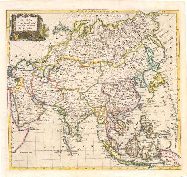
Subject: Asia

Period: 1770 (circa)

Publication: Guthrie's New Geographical Grammar

Color: Hand Color

Size:
14.3 x 13.3 inches
36.3 x 33.8 cm
Download High Resolution Image
(or just click on image to launch the Zoom viewer)

Thomas Kitchin was among the most productive English engravers of the eighteenth century. Hydrographer to the King, he was also a well known author, publisher and art shop keeper. Kitchin's work was distinguished by his crisp, concise engraving style. He prepared a number of maps of Asia in the latter part of the 18th century, each updated with the latest information. This map reflects the geography of the region prior to the discoveries of Capt. Cook's third voyage, with a partially delineated Company's Land, a fictitious island supposedly discovered by Jean de Gama. The depiction of Hokkaido and the west coast of the Malay Peninsula appear to follow French influences, such as Robert de Vaugondy.

References: Yeo #196.

Condition: B+

Issued folding, now pressed on watermarked paper with a binding trim at bottom left extended to better accommodate framing. There is faint offsetting, and some of the folds have been reinforced on verso with tissue.

Estimate: $300 - $400

Sold for: $220

Closed on 2/15/2012

Archived