Catalog Archive
Auction 139, Lot 599

One of the Earliest Maps of the Continent of Asia

"La Table de la Region Orientale, Comprenant les Dernieres Terres & Royaumes d'Asie", Munster, Sebastian
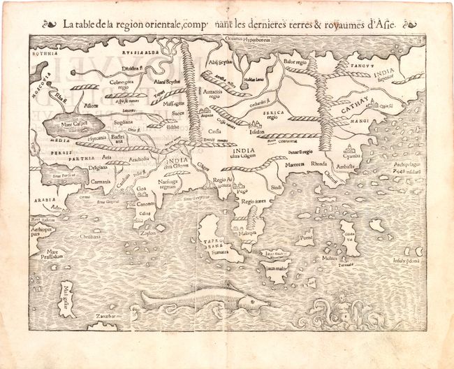
Subject: Asia

Period: 1560 (circa)

Publication: Geographia

Color: Black & White

Size:
13.5 x 10 inches
34.3 x 25.4 cm
Download High Resolution Image
(or just click on image to launch the Zoom viewer)

This map is based on the recent geographical discoveries by Portuguese navigators. The outline of the Asian mainland is relatively well-established, but Munster omits the extreme northeast of Asia, still believed to be joined to the New World. Japan is also lacking, as it appeared on Munster's New World map instead. India appears as a peninsula and Sri Lanka, called Zaylon, is correctly located. Cambay, Goa and Cannonore are all shown, reflecting the Portuguese presence on India's west coast, and this edition names Calicut, unlike the earlier examples of the map. Malacca is correctly located on the Malay Peninsula and the Indonesian island of Sumatra has inherited the name Taprobana from Sri Lanka, but also bears the name Sumatra. Java appears as two islands, Java Maior and Java Minor, shown north of the other. The famed Spice Islands of the Moluccas are located, but oddly shaped. An archipelago of 7448 islands lies off the eastern coastline of China, from the reports of Marco Polo. A huge sea monster and a fantastic two-tailed mermaid preside over the Indian Ocean. French text on verso.

References: Yeo #2; Walter #8A.

Condition: A

Light soiling and a few small damp stains confined to blank margins. There is some minor show-through of text on verso.

Estimate: $1,000 - $1,200

Sold for: $750

Closed on 2/15/2012

Archived