Catalog Archive
Auction 139, Lot 513
"Plan of St Petersburg; with it's Fortifications, Built by Peter the Great in 1703 [on sheet with] The Harbour of Crownslot River Neva, Canal Made from the Said River to the R. Wolschowa", Anon.
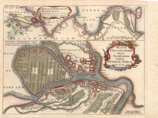
Subject: St. Petersburg, Russia
Period: 1749 (dated)
Publication: Gentleman's Magazine
Color: Hand Color
Size:
9.8 x 7.5 inches
24.9 x 19.1 cm
Download High Resolution Image
(or just click on image to launch the Zoom viewer)
(or just click on image to launch the Zoom viewer)