Catalog Archive
Auction 139, Lot 330

"Pascaarte Nieuwelyx Uytgegeven / Nieuwe Carybsche Pascaart The Carybes Ilands", Doncker, Henrick

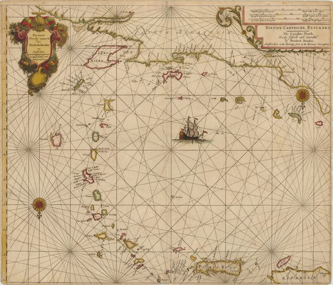
Subject: Puerto Rico and Lesser Antilles

Period: 1658 (circa)

Publication: Zee-Atlas ofte Water-Werelt…

Color: Hand Color

Size:
24.5 x 20.8 inches
62.2 x 52.8 cm
Download High Resolution Image
(or just click on image to launch the Zoom viewer)

This rare sea chart of the Lesser Antilles extends from the northern coast of South America to the eastern tip of Hispaniola. Two compass roses orient north to the bottom. The map is adorned with a decorative title cartouche, a secondary title cartouche incorporating the scale of miles, and a large sailing ship.

References: Shirley (BL Atlases) M.DON-2c, #48.

Condition: C

Original color, on double-thick paper, as issued. There is cracking in several areas caused by the oxidation of the green pigments, with some loss of image, including the island of St. Kitts, the coastline of South America, and a few holes in the left-hand title cartouche, with a portion in facsimile. All of the cracks have been reinforced on verso with old paper and tissue, although this map would benefit from further conservation.

Estimate: $1,600 - $2,000

Unsold

Closed on 2/15/2012

Archived