Catalog Archive
Auction 139, Lot 301

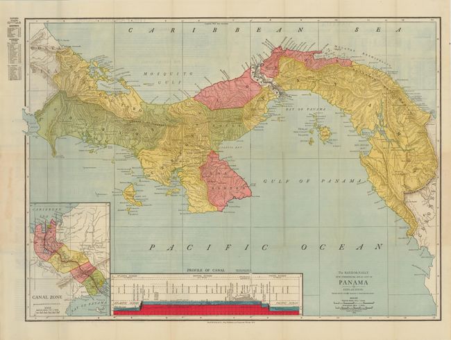
"The Rand-McNally New Commercial Atlas Map of Panama…", Rand McNally & Co.

Subject: Central America, Panama

Period: 1912 (dated)

Publication:

Color: Printed Color

Size:
25.8 x 19 inches
65.5 x 48.3 cm
Download High Resolution Image
(or just click on image to launch the Zoom viewer)

This is a very early commercial pocket map of Panama and the Canal Zone. The various departments are delineated along with an inset map of the Canal Zone and a profile view of the Canal showing the land that was cut away to facilitate the canal. The verso has an index of towns, rivers and mountains along with details of the Canal. The United States took over the French efforts to build the canal in 1904 and finally completed construction in January of 1914. Thus this map actually predates the completed canal and attests to the strategic and economic importance of this technological marvel. The map folds into original blue cloth covers.

References:

Condition: A

There is archival tape on verso to reinforce a few fold intersections, else fine.

Estimate: $200 - $250

Unsold

Closed on 2/15/2012

Archived