Catalog Archive
Auction 139, Lot 282

"Map of the United States and Texas, Designed to Accompany Smith's Geography for Schools", Burgess, Daniel

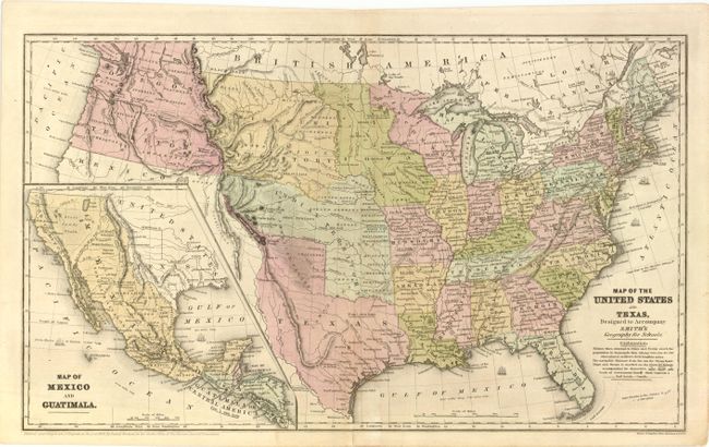
Subject: United States, Texas & Mexico

Period: 1839 (dated)

Publication: Smith's Geography for Schools

Color: Hand Color

Size:
17.5 x 10.5 inches
44.5 x 26.7 cm
Download High Resolution Image
(or just click on image to launch the Zoom viewer)

This great school atlas map with early territorial borders in the West features the Independent Republic of Texas with Austin shown as the capital by a large star. The Oregon Territory covers the northwest and extends well into Canada. The huge Indian Territory lies north of Texas and extends to the Missouri Territory, which in turn goes to the border with Canada. Iowa Territory is in a rare configuration, stretching from Missouri to the Canadian border and bounded east and west by the Mississippi and Missouri Rivers. The population is annotated for the states and Texas. The large inset at lower left is a detailed "Map of Mexico and Guatimala" and also shows the Republic of Texas, and the Spanish holdings in North America. Drawn and engraved by Stiles, Sherman & Smith.

References:

Condition: B+

Original color with faint offsetting. There is a short centerfold separation that just enters map border at bottom and has been closed on verso with Japanese tissue.

Estimate: $300 - $400

Sold for: $220

Closed on 2/15/2012

Archived