Catalog Archive
Auction 139, Lot 268

"Johnson's New Map of the State of Texas", Johnson & Ward
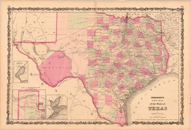
Subject: Texas

Period: 1861 (circa)

Publication: Illustrated Family Atlas of the World

Color: Hand Color

Size:
24.8 x 16.3 inches
63 x 41.4 cm
Download High Resolution Image
(or just click on image to launch the Zoom viewer)

The first edition of this handsome map, with county development mostly in eastern Texas and only the three large counties of El Paso, Presidio, and Bexar in the west. The panhandle, noted as the Staked Plain (Elevated Table Land, without Wood or Water), includes a large section that is unorganized. There are numerous wagon roads, a few completed railroads, and the US Mail Route traced on the chart. Insets include a Plan of Sabine Lake, Plan of the Northern part of Texas, and Plan of Galveston Bay. Surrounded by Johnson's early strapwork border. Blank on verso.

References: cf. Day #1416.

Condition: B+

Original color with some scattered foxing and a hint of toning.

Estimate: $200 - $250

Sold for: $150

Closed on 2/15/2012

Archived