Catalog Archive
Auction 139, Lot 231

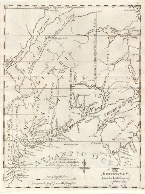
A very early map of Maine

"The District of Main from the Latest Surveys", Morse, Jedidiah (Rev.)

Subject: Maine

Period: 1793 (published)

Publication: American Universal Geography

Color: Black & White

Size:
8 x 10.5 inches
20.3 x 26.7 cm
Download High Resolution Image
(or just click on image to launch the Zoom viewer)

This scarce and finely engraved map from the American Universal Geography is considered the first obtainable map that focuses on Maine. The northwest boundary with Canada has the notation "High Lands Being the Boundaries between the United States and Canada." This gives a northern border further north than that which was eventually decided. Only four counties are noted and Moosehead Lake is misspelled Mousehead Lake. Longitude is measured east from Washington. This early edition varies from later Morse issues with finer engraving, a notation to the left of the compass rose, the title contained in an oval cartouche, and no outer neatline.

References: Wheat & Brun #168.

Condition: B+

There are two tiny fold separations that just pass the neatline that have been reinforced with archival tape on verso, else near fine. Issued folding.

Estimate: $350 - $425

Sold for: $350

Closed on 2/15/2012

Archived