Catalog Archive
Auction 139, Lot 204

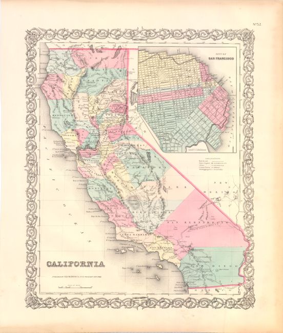
"California", Colton, Joseph Hutchins

Subject: California

Period: 1855 (dated)

Publication:

Color: Hand Color

Size:
13 x 15.8 inches
33 x 40.1 cm
Download High Resolution Image
(or just click on image to launch the Zoom viewer)

This is one of the best mid-nineteenth century atlas maps of California. It shows the entire state with Utah and New Mexico territories on the eastern border. Two proposed railroad routes through the Central Valley are labeled "Explored Route for Atlantic & Pacific R.R." and a northern route through Fredonyers Pass, north of Pyramid Lake, is marked "Practicable Route for Atlantic & Pacific R.R." The only completed railroads service the Gold Regions and Sacramento. A huge inset titled "City of San Francisco" shows the planned land expansion into the bay with the streets already drawn in.

References:

Condition: A

A hint of toning in the blank margins, else fine.

Estimate: $150 - $200

Sold for: $110

Closed on 2/15/2012

Archived