Catalog Archive
Auction 139, Lot 183

"Map of the Province of West Florida", Kitchin, Thomas

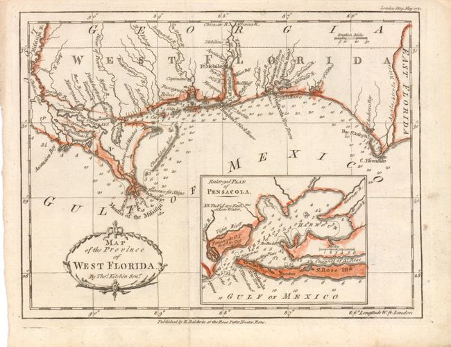
Subject: West Florida, Gulf Coast

Period: 1781 (dated)

Publication: London Magazine

Color: Hand Color

Size:
9.5 x 7.3 inches
24.1 x 18.5 cm
Download High Resolution Image
(or just click on image to launch the Zoom viewer)

This scarce chart of the British colony of West Florida is filled with soundings along the coastline and extends to the eastern tip of Louisiana, including New Orleans. West Florida remained loyal to Britain during the American Revolution, and was a haven for Tories fleeing from the Thirteen Colonies. After Spain entered the war in 1779, the governor of Spanish Louisiana began attempts to gain control of the region, gaining control of Mobile in 1780 and besieging Pensacola in 1781. A large inset map depicts Pensacola Harbor with a note that Pensacola was destroyed in 1719, when the French captured it from the Spanish in a previous conflict attesting to its strategic importance to the colonial powers in North America.

References: Jolly #LOND-341; Sellers & van Ee #1652.

Condition: A

Issued folding with light toning in blank margins.

Estimate: $300 - $400

Sold for: $300

Closed on 2/15/2012

Archived