Catalog Archive
Auction 139, Lot 157

"A Map of the Colony of Rhode Island: with the Adjacent Parts of Connecticut, Massachusets Bay. &c.", Kitchin, Thomas

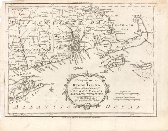
Subject: New England - United States

Period: 1778 (dated)

Publication: London Magazine

Color: Black & White

Size:
9.5 x 7 inches
24.1 x 17.8 cm
Download High Resolution Image
(or just click on image to launch the Zoom viewer)

A scarce small map of Rhode Island extending north to Boston and Boston Harbor, and south to Long Island, New York. Martha's Vineyard and Nantucket Island are depicted, along with the roads, towns and rivers in the region. The map illustrates a major theater in the war for American independence following France’s recognition of the United States. American and British forces had been at a standoff at Newport since the beginning of the war. News of the French involvement rallied support for the cause, and militia began streaming into Rhode Island from the adjacent colonies. Several small conflicts culminated in the Siege and Battle of Rhode Island on August 29, 1778. The map is adorned with a decorative title cartouche and compass rose.

References: Jolly #LOND-327; Sellers & Van Ee #825.

Condition: A

Issued folding with a few tiny tears and light soiling in blank margins.

Estimate: $300 - $375

Sold for: $220

Closed on 2/15/2012

Archived