Catalog Archive
Auction 138, Lot 849

"Chart of the Island and Harbour of Tongataboo",

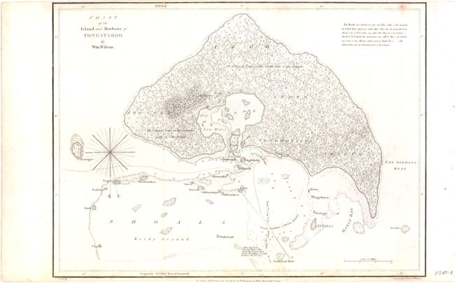
Subject: South Pacific Ocean, Tonga

Period: 1799 (dated)

Publication: A Missionary Voyage to the Southern Pacific Ocean

Color: Black & White

Size:
15 x 11 inches
38.1 x 27.9 cm
Download High Resolution Image
(or just click on image to launch the Zoom viewer)

Tongatapu is the southernmost island cluster of the Kingdom of Tonga, in the southwestern Pacific Ocean. It is 2,000 miles northeast of Sydney, Australia. The capital of Tonga, Nuku'alofa, is on the north coast of Tongatapu, and is shown as Noogholifva on this map. Numerous roads are shown and there is a large natural harbor protected by reefs. However, there is a note: "Here Capt. Cook and Capt. Clarke's Ships struck the Ground which proves the danger of coming in East of the N.E. Reef." The map was drawn by William Wilson and engraved by Thomas Foot. It is from the description of the first British missionary voyage to the South Pacific. North is to the bottom on this map.

References:

Condition: B+

Top and bottom margins closely follow the neatline. There is some light scattered staining primarily at the top and bottom of image.

Estimate: $100 - $130

Sold for: $75

Closed on 12/7/2011

Archived