"Perigrinatie ofte Veertich-iarige Reyse, der Kinderen Israels uyt Egipten, door de Roode-Zee; mitsgaders de Woestijne tot int Beloofde Landt Canaan …", Visscher, Claes Janszoon
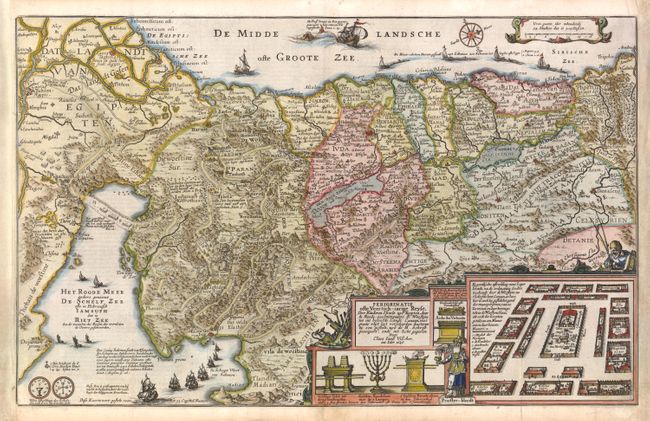
Lavishly decorated map of the Holy Land depicting the flight from Egypt. The Holy Land is divided among the tribes. The Kishon River connect the Mediterranean to the Sea of Galilee. There are numerous embellishments, including depictions of the encampment of the Children of Israel, temple vessels, Aaron & Moses, both sides of a shekel coin, a charming scene of Jonas and the whale, and several of Solomon's ships. Visscher's emblem, an old fisherman, is at right. Published in a Dutch Bible, with text on verso. This is the third state of this map, with the first state dated 1642.
References: Laor #785; Poortman & Augusteijn #85.
Condition: B+
Remargined at right and left to accommodate framing, with neatline in facsimile at bottom right. A few short fold separations have been professionally repaired, and there is marginal soiling.