Catalog Archive
Auction 138, Lot 649

"Delineatio Freti Vaigats", Bertius, Petrus

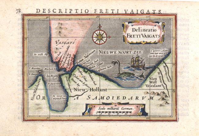
Subject: Vaygach Island, Russia

Period: 1618 (circa)

Publication: Tabularum Geographicarum Contractarum

Color: Hand Color

Size:
5.3 x 3.8 inches
13.5 x 9.7 cm
Download High Resolution Image
(or just click on image to launch the Zoom viewer)

This miniature map shows the straits between mainland Russia and Vaygach Island, an area that was discovered by western Europeans during their search for a northern passage to Asia. The first visit was by Hugh Willoughby in 1553. Then in 1596, Willem Barents rounded the north point of Novaya Zemlya, and wintered on the east coast near the northern tip. At the time Vaygach Island was thought to be a part of Novaya Zemlya. The map is decorated with a sailing ship, compass rose, spouting whale, and a nice title cartouche. Latin text on verso.

References: King (2nd ed.) pp. 80-82.

Condition: A

Marginal soiling.

Estimate: $110 - $140

Sold for: $80

Closed on 12/7/2011

Archived