Catalog Archive
Auction 138, Lot 630

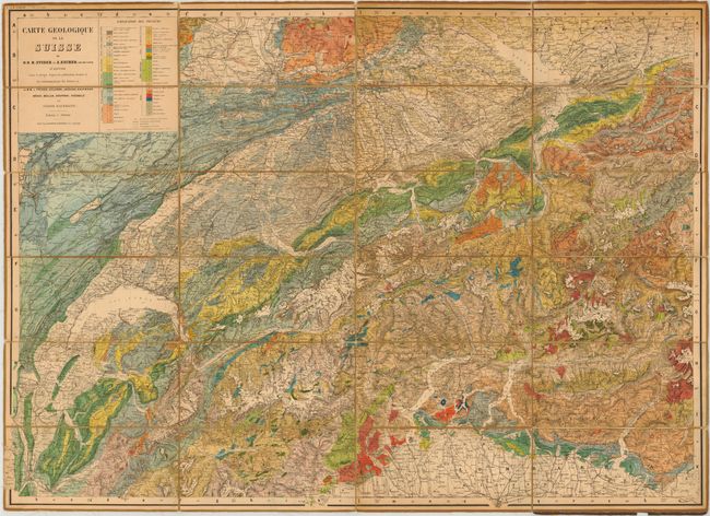
"Carte Geologique de la Suisse…",

Subject: Switzerland

Period: 1867 (published)

Publication:

Color: Printed Color

Size:
39 x 27.8 inches
99.1 x 70.6 cm
Download High Resolution Image
(or just click on image to launch the Zoom viewer)

This very colorful geologic map of Switzerland covers the area from Geneva west to Glurns and from Basel south to Milan. 49 different geologic units are represented in 20 colors. The map shows incredible topography along with detail of lakes, rivers and towns. On verso is a small map of Switzerland showing existing and proposed railroads and notes elevation at various points. Folds into original cloth covers with gilt title on front cover. Drawn by B. Studer and A. Escher. This is the second edition.

References:

Condition: B+

Dissected and mounted on original linen. There is some light soiling primarily around the edge of the sheet and the linen has separated along a few folds. The covers are worn.

Estimate: $275 - $350

Sold for: $200

Closed on 12/7/2011

Archived