Catalog Archive
Auction 138, Lot 55

"L'Hemisphere Septentrional pour voir plus distinctement les Terres Arctiques…", Delisle/Covens & Mortier

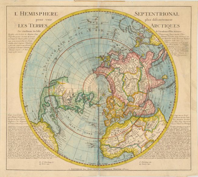
Subject: Northern Hemisphere

Period: 1740 (circa)

Publication: Atlas Nouveau

Color: Hand Color

Size:
20.3 x 18 inches
51.6 x 45.7 cm
Download High Resolution Image
(or just click on image to launch the Zoom viewer)

This important map, originally produced by Guillaume Delisle in 1714, was published by Covens and Mortier. The map went through several revisions to reflect later discoveries. This version is derived from Ivan Kyrilow's 1734 map of the Russian Empire and from Spanberg and Bering's discoveries in northeast Asia. California is correctly shown as a peninsula, but with a dotted line still hinting at the possibility of the island form. The entire northwest coast is blank above Cap Blanc. Terre de la Compagnieappears off the northeast coast of Asia with a note about its discovery by Jean de Gama. Above that the map now includes a fairly accurate depiction of Kamchatka. Text panels have been added to include a letter (printed in French and Dutch), dated Jan. 13, 1740, from Mr. Swartz, Dutch ambassador at St. Petersburg, announcing Lt. Morten Spanberg's recent discoveries in the vicinity of Kamchatka and noting his competition with Bering.

References: Wagner #504.

Condition: B+

There are a few edge tears that have been repaired with archival material on verso with some light soiling in the blank areas of the image.

Estimate: $275 - $350

Sold for: $200

Closed on 12/7/2011

Archived