Catalog Archive
Auction 138, Lot 497

"A Correct Plan of the Cities of London & Westminster & Borough of Southwark, Including the Bills of Mortality with the Additional Buildings &c.…", Rocque, John

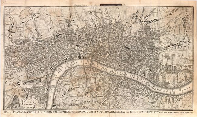
Subject: London, England

Period: 1761 (dated)

Publication: London Magazine

Color: Black & White

Size:
15.8 x 8.8 inches
40.1 x 22.4 cm
Download High Resolution Image
(or just click on image to launch the Zoom viewer)

This is very detailed plan of the city of London and surrounding areas. The plan spans from Hyde Park east to Bednal Green and from St. George's Fields north to New River Head. The map is centered on Fleet Street and shows numerous important locations including the Tower of London, Parliament and London Bridge. The Bills of Mortality referred to in the title were the areas in Greater London that reported death notices directly to the London government.

Interestingly, the publication information above the print has been blocked out, but one can clearly decipher that it was issued in the June 1761 edition of the London Magazine.

References: Jolly LOND-202; Howgego #120.

Condition: B

There is some uneven toning primarily in the center and upper right portions of the image. Ink marks cover part of the attribution above the image. Issued folding.

Estimate: $150 - $200

Sold for: $300

Closed on 12/7/2011

Archived