Catalog Archive
Auction 138, Lot 481

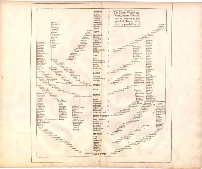
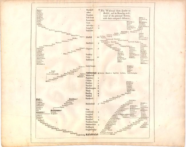
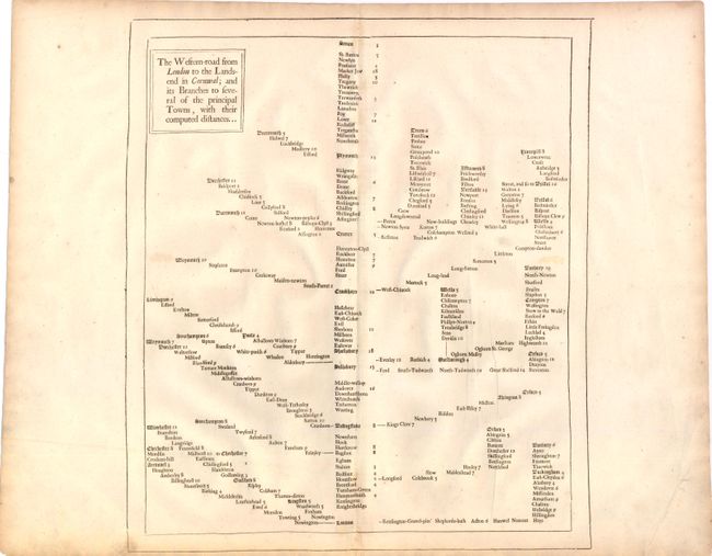
"[Lot of 3] The North-West-Road from London to Hollyhead; and its Branches to the Principal Towns, with their Computed Distances [and] The West-Road from London to Bristol… [and] The Western-Road from London to the Landsend in Cornwal…", Speed, John

Subject: England

Period: 1676 (published)

Publication: Theater of the Empire of Great Britain

Color: Black & White

Size:
14 x 16 inches
35.6 x 40.6 cm
Download High Resolution Image
(or just click on image to launch the Zoom viewer)

These unusual diagrammatic tables of road distances depict the routes between London and Holyhead in Wales, Bristol, and Land's End, the southwestern tip of England. These are three of the five thematic road maps of England that were included in the 1676 edition of John Speed's Theater of the Empire of Great Britain. Each map shows the place names and distances between towns beginning in London and branching out through numerous roads in a specific direction. This lot includes:

A. The North-West-Road from London to Hollyhead; and its Branches to the Principal Towns, with their Computed Distances.

B. The West-Road from London to Bristol; and its Branches to Several of the Principal Towns, with their Computed Distances.

C. The Western-Road from London to the Landsend in Cornwal; and its Branches to Several of the Principal Towns, with their Computed Distances.

References: Akeman, p. 41-42.

Condition: B+

Watermarked paper with wide side margins and light toning along centerfold and in blank margins. There are a few minute worm holes, only visible when held to light.

Estimate: $600 - $800

Sold for: $450

Closed on 12/7/2011

Archived