Catalog Archive
Auction 138, Lot 460

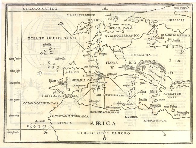
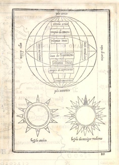
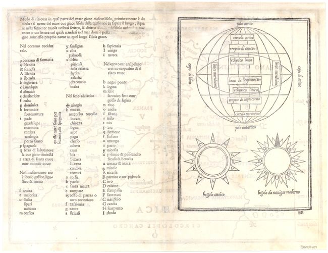
"[Europe and on verso Planispherical Diagrams]", Bordone, Benedetto

Subject: Europe

Period: 1528 (circa)

Publication: Isolario

Color: Black & White

Size:
15.3 x 11.3 inches
38.9 x 28.7 cm
Download High Resolution Image
(or just click on image to launch the Zoom viewer)

This sheet contains the first two maps from Bordone's atlas Isolario, published between 1528-1547. Bordone's Isolario was one of the earliest and most important works of its time. It is remarkable for being the first atlas covering the entire world not based on classical geography, but rather on contemporary information. Bordone was an illuminator and wood-engraver working in Venice, when he was given permission by the Senate to print maps of Italy and the world. None of those maps have survived and his only remaining works are the maps from the Isolario (Island Book).

This scarce woodblock map of Europe extends to include much of northern Africa. The British Isles and Scandinavia are depicted with preliminary outlines and locations. This is one of the first maps to show the islands in the Mediterranean, as well as numerous islands in the Atlantic, in detail. On verso are a keyed index to the map along with planispherical diagrams.

References: Nordenskiold #27-2, #28-2, #30-2.

Condition: B

Watermarked paper with small wormholes that have been professionally repaired, with a small amount of image in facsimile. The full centerfold separation has been expertly repaired, with a small amount of image in facsimile. The margin has been extended at top to accommodate framing and there is light show-through of text and diagrams on verso.

Estimate: $1,600 - $2,000

Sold for: $1,300

Closed on 12/7/2011

Archived