Catalog Archive
Auction 138, Lot 399

"Novissima et Acuratissima Barbados. Descriptio", Ogilby, John

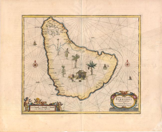
Subject: Barbados, Lesser Antilles

Period: 1671 (circa)

Publication: America, being the latest and most accurate description of the New World

Color: Hand Color

Size:
14 x 11.5 inches
35.6 x 29.2 cm
Download High Resolution Image
(or just click on image to launch the Zoom viewer)

This early map of Barbados shows coastal features without inland detail. The interior is filled with a vignette of a sugar mill surrounded by depictions of the bounty of the island, including pineapple, sugar cane, a cabbage tree, papaw, Beunawno, and Indian corn. Numerous windmills and the names of early landowners are shown along the coastline. Ogilby is not known to have traveled to Barbados, and his sources for this map are unknown.

References: Campbell (MCC-21) #3.

Condition: B+

Wide margins with marginal soiling and a light crease at right. There are two minute holes in upper right corner and a centerfold separation that enters map image 1" at bottom that has been repaired with archival materials.

Estimate: $1,000 - $1,200

Unsold

Closed on 12/7/2011

Archived