Catalog Archive
Auction 138, Lot 274

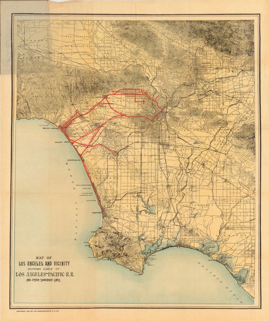
"Map of Los Angeles and Vicinity Showing Lines of Los Angeles - Pacific R. R. and Other Suburban Lines", Railroad Companies, (Various)

Subject: Los Angeles, California

Period: 1904 (dated)

Publication:

Color: Printed Color

Size:
20.3 x 24 inches
51.6 x 61 cm
Download High Resolution Image
(or just click on image to launch the Zoom viewer)

This very early pocket map of Los Angeles County highlights the expanding network of railroad lines in the area. The railways in the areas of greatest development are highlighted in red, and go from downtown Los Angeles west to the ocean at Santa Monica and south along the coast to Redondo Beach. Additional inland railroad detail is highlighted in black. The map folds into original green paper wrappers, titled Souvenir Map Balloon Route. Published by the Los Angeles Pacific Railroad. The Los Angeles and Pacific Railway eventually became part of the Pacific Electric System, also known as the Red Car system, which went on to become the largest electric railway in the world when it reached its largest extent in 1925.

References:

Condition: A

Exceptional condition for this type of ephemera. There is one tiny split at a fold intersection, else fine. Paper wrappers are discolored.

Estimate: $300 - $400

Sold for: $1,000

Closed on 12/7/2011

Archived