Catalog Archive
Auction 138, Lot 177

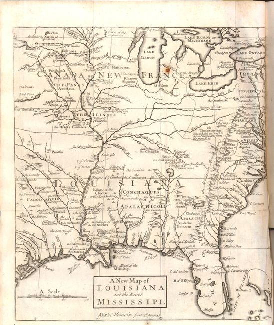
"A New Map of Louisiana and the River Mississipi [within book] The Memoirs and Secret Negotiations of John Ker", Anon.

Subject: Colonial United States

Period: 1726 (published)

Publication:

Color: Black & White

Size:
9 x 10.2 inches
22.9 x 25.9 cm
Download High Resolution Image
(or just click on image to launch the Zoom viewer)

This interesting map focuses on the French empire in the heart of North America, embracing both the Great Lakes and the Mississippi Valley. It illustrates the French threat to the British colonies that are confined along the Atlantic seaboard by the Appalachian Mountains. French trading posts, lead mines, trails, and Indian villages are carefully noted and the Indian nations are prominently named. The Missouri River emanates from a great lake in the northwest that disappears off the map and another Great River flows west from Lack Pani; both alluding to the possibility of a passage to the Pacific.

This map is bound in The Memoirs and Secret Negotiations of John Ker . This is volume two of a three volume set, focusing primarily on the French Possessions in America and the negotiations with Ker, a British spy. 184 pp. with an index. Contemporary full calf with raised bands on the spine.

References: cf. Cumming (SE) #176.

Condition: B

Condition code is for the map. There is a small stain near the Great Lakes and a tiny tear and minor crumpling at the right margin where the map is bound to the book. Book pages are tight and mostly clean. The hinge is perished but the boards are in good condition and intact.

Estimate: $800 - $1,000

Sold for: $500

Closed on 12/7/2011

Archived