Catalog Archive
Auction 137, Lot 906

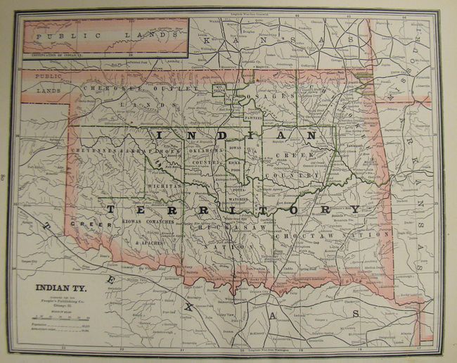
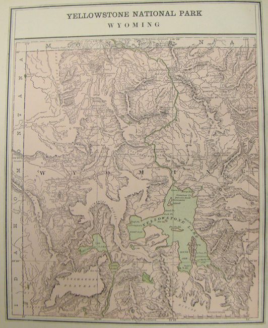
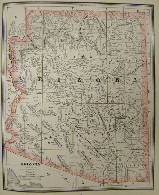
"The People's Illustrated & Descriptive Family Atlas of the World", People's Publishing Co.

Subject: Atlases

Period: 1888 (published)

Publication:

Color: Printed Color

Size:
12 x 14 inches
30.5 x 35.6 cm
Download High Resolution Image
(or just click on image to launch the Zoom viewer)

This is the thirteenth edition, revised to July, 1888 and is complete with 83 single-page and 33 double-page cerographic maps and plans. The atlas includes individual maps for each U.S. state and territory, the Canadian provinces, the world and continents. It also includes several pages of plans of the principal cities of the United States, a bird's-eye view of the Holy Land, and dozens of engraved vignettes of distant civilizations, architecture, wildlife, landscapes, etc. interspersed throughout the text. There are also illustrations of state seals, the flags and coats of arms of various nations, and an amusing page of client testimonials. Double-page maps are folded and pasted to a backstrap and most maps are printed back to back. 450 pages with numerous illustrations. Small folio. Bound in brown, pebble-grain cloth, with an attractive, embossed title on both the front and back covers, with the front cover in gilt. Red paper edges. Published by Donohue & Henneberry, Chicago.

References:

Condition: A

Contents near fine with just a hint of toning along edges, and light stains on a few index pages. Covers are lightly worn and a bit rubbed, corners bumped. The spine shows some wear. The binding is sound. This is a nice example with all maps clean and bright, fine.

Estimate: $350 - $450

Sold for: $220

Closed on 9/14/2011

Archived