Catalog Archive
Auction 137, Lot 786

Blaeu's Carte-a-Figures Map of Africa

"Africae Nova Descriptio", Blaeu, Willem
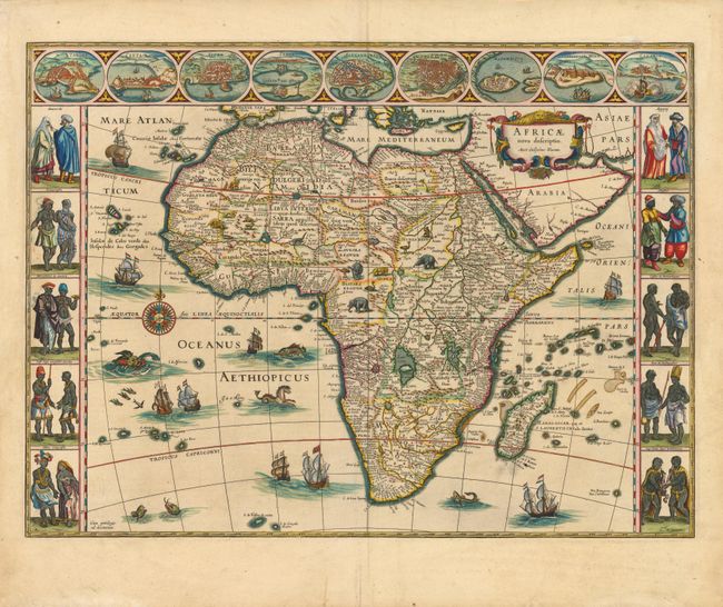
Subject: Africa

Period: 1631 (published)

Publication: Atlas Appendix

Color: Hand Color

Size:
22 x 16 inches
55.9 x 40.6 cm
Download High Resolution Image
(or just click on image to launch the Zoom viewer)

This is one of the most decorative seventeenth century maps of the African continent and a superb example of the Dutch carte-a-figures style. The map is surrounded on three sides with vignettes of native peoples and nine principal cities. The Nile is shown according to Ptolemy with its sources arising in the lakes Zaire and Zaflan, the fictitious Lake Sachaf of Laurent Fries appears, as well as the R. de Spirito Santo. The map is further embellished with numerous ships, sea monsters (including a great seahorse), a compass rose and exotic animals wandering all over the continent. This is the second state of the map. French text on verso.

References: Betz #57.2; Norwich #32.

Condition: A

Lovely color with a short centerfold separation in bottom margin that has been professionally closed, and two short creases also in bottom blank margin. A small spot of printer's ink residue below Madagascar, and very minor soiling in blank margins.

Estimate: $4,000 - $5,000

Sold for: $2,500

Closed on 9/14/2011

Archived