Catalog Archive
Auction 137, Lot 640

"Le Golfe de Venise, Avec ses Principaux Caps, Promontoires, & Ports de Mer…", Jaillot, Alexis-Hubert

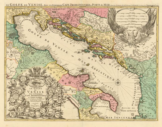
Subject: Italy, Balkans

Period: 1710 (circa)

Publication:

Color: Hand Color

Size:
29 x 21.5 inches
73.7 x 54.6 cm
Download High Resolution Image
(or just click on image to launch the Zoom viewer)

This beautiful large map of the Gulf of Venice and the Adriatic Sea illustrates the theater of the Ottoman-Venetian Wars.. The map covers the eastern coast of Italy and follows the coastline of the Adriatic to the Balkan states. The region was contested between the Ottoman Empire and the Republic of Venice from the 15th through the early 18th centuries with seven major conflicts. Political divisions are shown in different colors and each has their respective coat of arms displayed. There is an impressive title cartouche at lower left that features the plans for 22 different coastal fortifications surrounding a scene of Venice and topped by the Hapsburg coat of arms. At top right is a cartouche with six different distance scales above a winged and crowned lion with the gospel representing the Republic of Venice. The map is based on the cartography of Coronelli and Sanson and was published by Covens and Mortier.

References:

Condition: B+

Strong impression with original color and full margins. There is one small tear in the upper portion that extends 1.5" beyond the neatline but has been repaired on verso. Some very minor crumpling in the lower and upper blank margins.

Estimate: $1,200 - $1,600

Sold for: $800

Closed on 9/14/2011

Archived