Catalog Archive
Auction 137, Lot 57

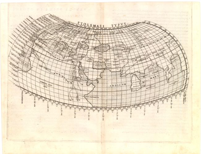
"Ptolemaei Typus", Ruscelli, Girolamo

Subject: Ancient World

Period: 1561 (published)

Publication: La Geografia de Claudio Tolomeo Allessadrino…

Color: Black & White

Size:
11.5 x 7 inches
29.2 x 17.8 cm
Download High Resolution Image
(or just click on image to launch the Zoom viewer)

This Ptolemaic map of the ancient world follows the classical format in a restrained and simple style. The Mediterranean is well depicted, but greatly exaggerated in length. In Africa, the Nile is shown originating from mountains south of the equator. The Indian Ocean is landlocked with a continuous coastline joining Africa to South East Asia. Toprobana, present day Sri Lanka, is a very large island in the Indian Ocean and the Indian sub-continent is completely missing, although the Ganges River is shown. Copper engraving in the Italian style with a stippled sea. This is the first state, as evidenced by the lack of the top platemark; two maps were printed from the same plate for the first edition. Latin text on verso.

References: Shirley #109.

Condition: A

Lightly toned along centerfold with a tiny bit of soiling in blank margins.

Estimate: $450 - $550

Sold for: $375

Closed on 9/14/2011

Archived