Catalog Archive
Auction 137, Lot 566

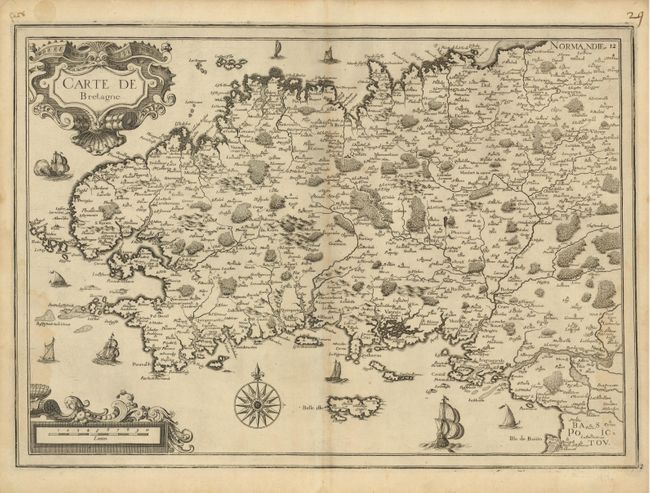
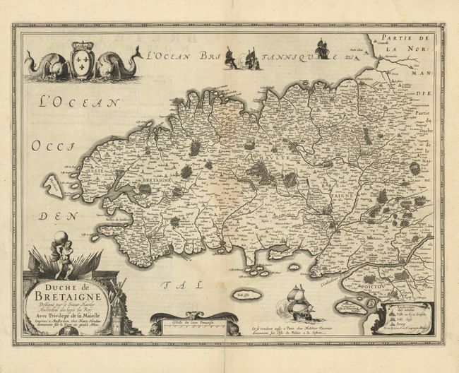
"[Lot of 2] Carte de Bretagne [and] Duche de Bretaigne",

Subject: Brittany, France

Period: 1634 (circa)

Publication:

Color: Black & White

Size:
See Description
Download High Resolution Image
(or just click on image to launch the Zoom viewer)

Both of these maps of Brittany are beautifully engraved with graphic illustrations of the forests and topography and richly embellished with elaborate cartouches, ships and sea monsters.

A) Carte de Bretagne, by Nicolas Tassin, from Les Atlas Francais XVI-XVIIe siecles (20.5 x 14.5"). Faintly toned on centerfold, else very good. (B+)

B) Duche de Bretaigne, drawn by Le Sieur Claude Hardy for Jodocus Hondius, and published by Melchior Tavernier (19.8 x 14.7"). Faintly toned on centerfold with a tear on the bottom centerfold that enters 1" into the map. (C+)

References:

Condition:

See descriptions.

Estimate: $400 - $500

Sold for: $200

Closed on 9/14/2011

Archived