Catalog Archive
Auction 137, Lot 565

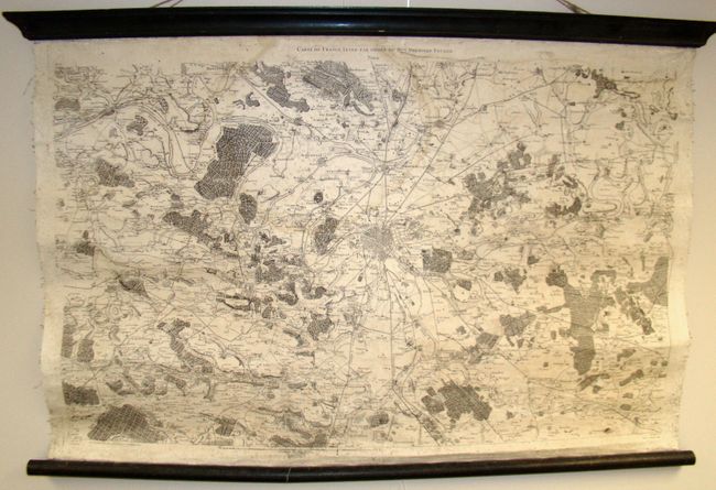
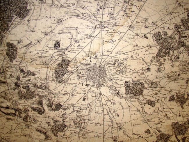
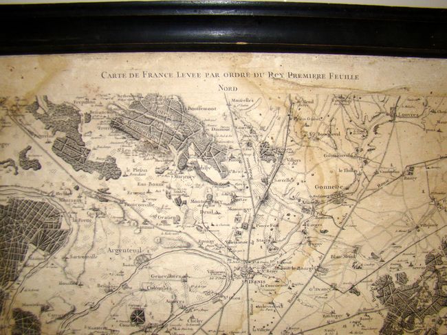
"Carte de France Levee par Ordre du Roy Premiere Feuille", Cassini de Thury, Cesar Francois

Subject: Paris, France

Period: 1750 (circa)

Publication:

Color: Black & White

Size:
40 x 27 inches
101.6 x 68.6 cm
Download High Resolution Image
(or just click on image to launch the Zoom viewer)

This wall map is the first of 182 maps of various parts of France by the Cassini family, which create a unified view of the country when joined. The maps were based on the first national survey completed on the same scale and used trigonometric surveying techniques, which resulted in a high degree of accuracy for the time period. This bird's-eye view centers on Paris, with great detail of the surrounding towns, roads, and forested areas. The prime meridian passes through the Paris Observatory, where four generations of the Cassini family held the position of director. Engraved by R. Brunet.

References:

Condition: C+

Map is buckled, with toning, a few stains, and scattered foxing. Mounted on wooden rollers, with the lower wooden roller cracked in half, but stable. Backed with linen.

Estimate: $200 - $250

Sold for: $150

Closed on 9/14/2011

Archived